
|
|
|
Minimizing the Impact of Water Disasters : The 2001 Floods in Mozambique - Enrique Munoz Leira
|
|
| 3. The 1999-2000 Emergency |
| |
|
In September 1999, the Southern African Regional Climate Outlook Forum (SARCOF), met in
Maputo and predicted "high probabilities of normal to above-normal rainfall conditions over
much of southern Africa" during the rainy season October 1999-March 2000. The forecast for
southern Mozambique was a 50% probability of above average rainfall in October-December 1999
and a 30% probability of above average rainfall in January-March 2000. The forecast
announced was very serious and the reality was still worst than predictions as everyone
remember from the impressive images shown on the main international TV chains.
|
| |
|
The 1999-2000 floods were caused by record rains at least in the past 50 years due to
unprecedented weather patterns involving cyclones and storms, linked to La NiСЃa, a warmer
Indian Ocean, global warming and a peak of natural weather cycles. Also, human activity,
dams management and changes of land use patterns made the floods worse.
|
| |
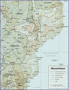
Map of Mozambique
(View Larger Image)
|
|


 Related documents